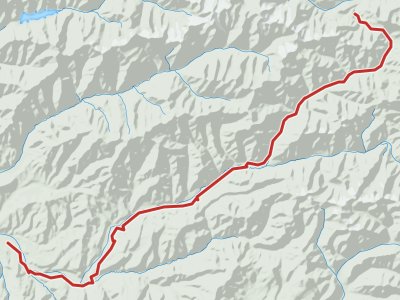
Day #5 How I Walked
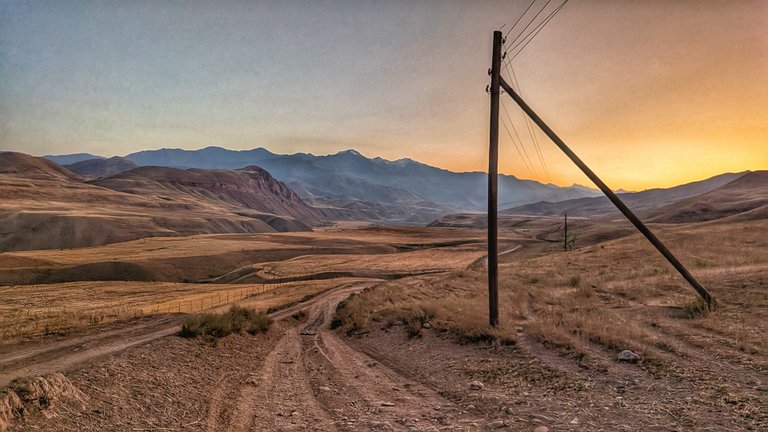
I set the alarm on my watch so it wouldn’t wake anyone up in the police station. I’m not a monster. Others wanted to get up an hour after me, but I had catching up to do. 4 a.m. was just right. Even so, I’d slept unusually long; I would’ve gotten up earlier, but I didn’t want to enter the tough section in the dark. I didn’t realize I still had a long way to go before I even reached it.
In the last village on the route, it was still dark. From the tracker I knew Tony, with whom I did the acclimatization ride, was sleeping somewhere there. I slipped past him like a mouse.
Soon I found myself in an endless valley with the wind lashing my face. The road, though wide, wasn’t great, and I could barely move. I came upon several tents. The other racers were still asleep. They were missing out on a lot of beauty.
The route cut into the mountainside—climb after climb—but it still wasn’t THE section. I just couldn’t get going and a few people caught up to me.
☠️ This was too much for me
I entered a guarded border zone. I passed through something that looked partly like a military outpost and partly like a stable with livestock. I only met a single herder there, and the checkpoint we’d been warned about didn’t happen. Maybe it was too early for the guards.
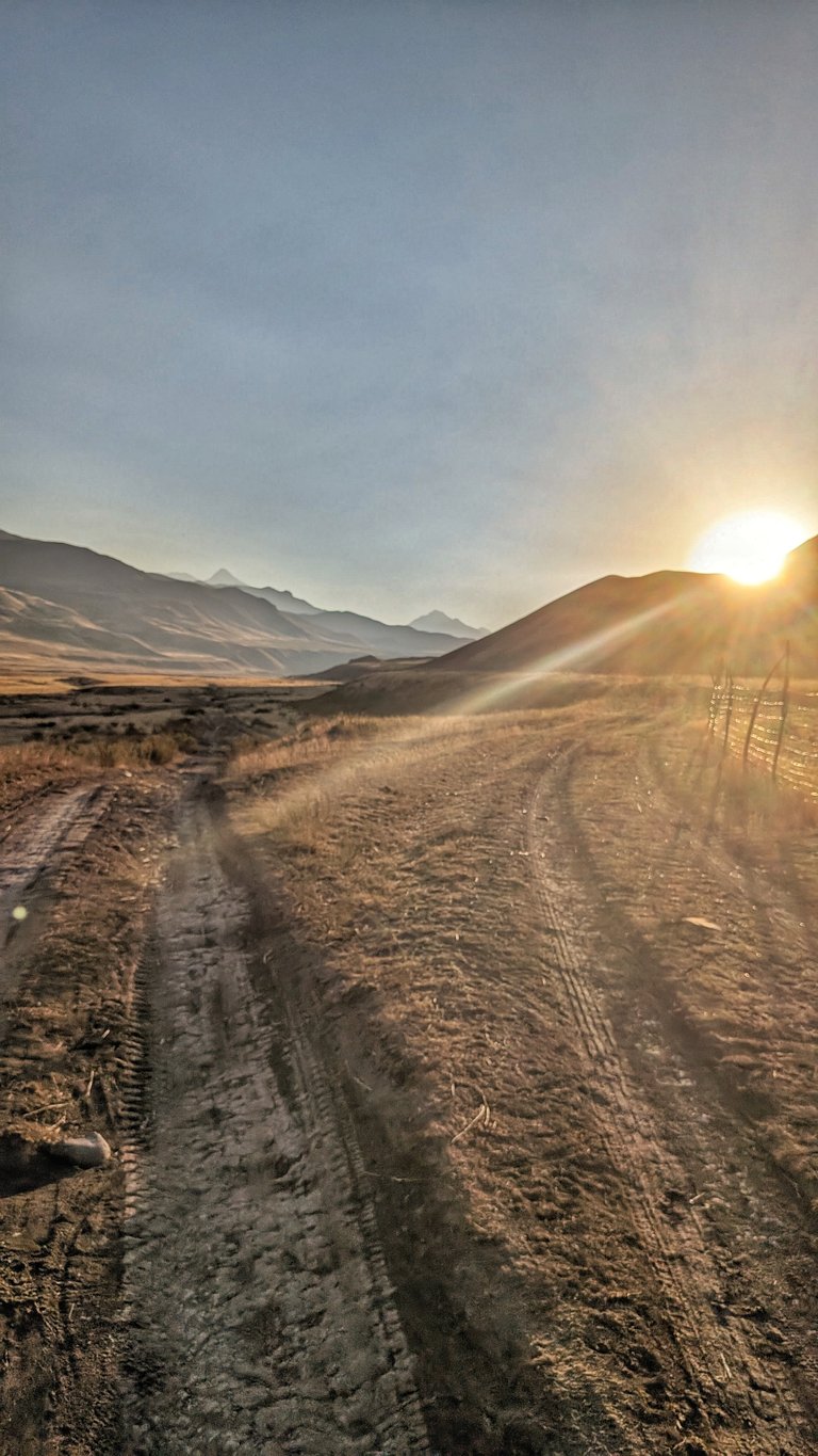
The hiking section I had just entered was described by Nelson as not super steep, but very long. That was half true. It was very long. And often also super steep.
Those 30 kilometers went roughly like this: a path—more like a cattle trail—very narrow, winding along the slope. A river ran through the valley, separated from me by a massive cliff. The route didn’t follow the contour; it kept scrambling up and then dropping down. The brave could ride the descents, but they risked a several-meter—and in some sections a several-hundred-meter—fall, so I ruled that out.
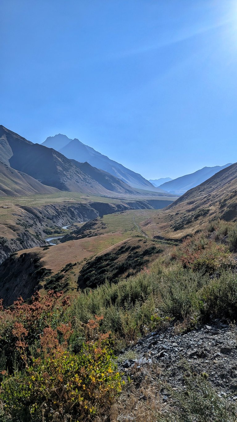
The trail took me to the river many times, which I had to ford. There wasn’t that much water, but the current was very strong. I took off my socks but waded in my shoes. According to the organizer there were supposed to be three big crossings. When I was stepping through the seventh, I stopped believing that claim.
In some sections the little track was extremely narrow and traversed across loose scree, where I moved extremely carefully. The worst part was where I was inching my bike along an almost vertical wall, with the threat of a several-hundred-meter plunge into the river. That was a bit too much for me and, in my opinion, doesn’t belong in a race. My legs were already extremely tired and at times I was staggering.
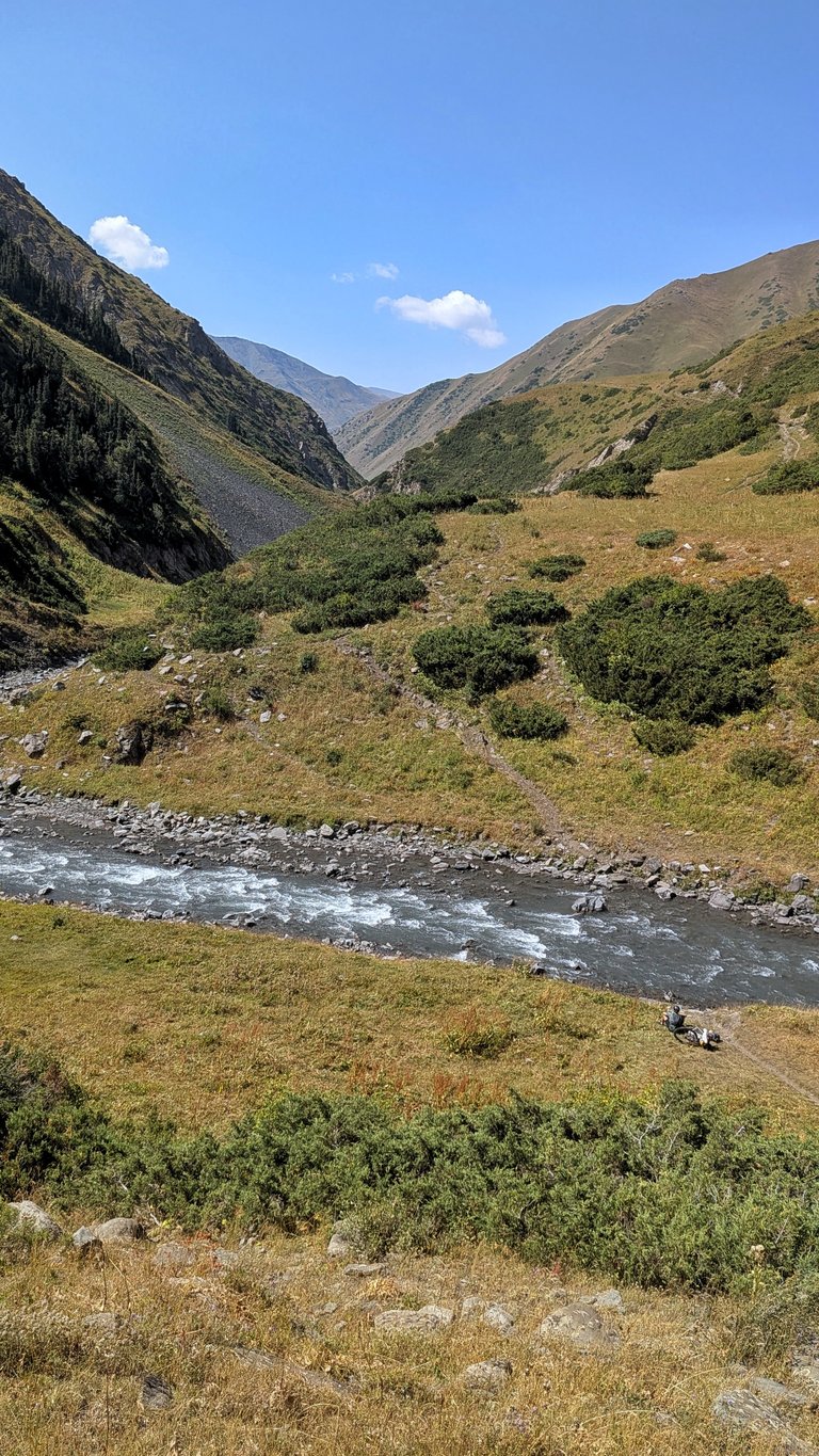
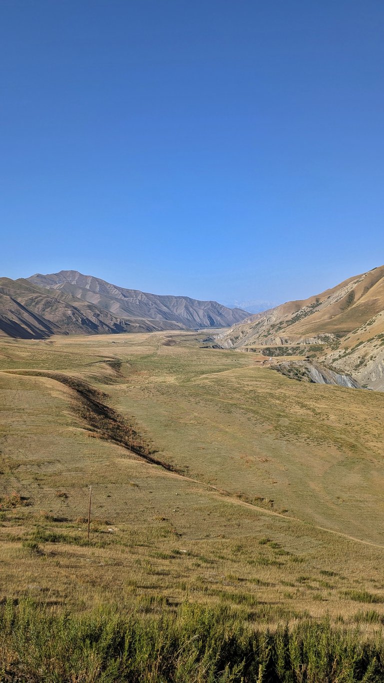
🤽♂️ Is it a trail or a creek?
The map data for that place was poor and it was hard to even find the path. I didn’t know when I was supposed to cross the river and when not to. The footpath kept splitting, rejoining, and had dead ends. No way I’d have managed it at night.
Towards the top the trail straightened a bit and was rideable, but my legs were so tired I didn’t feel like pedaling. Deep gullies with little streams cut across the route—you had to drop into them, wade across, and climb back out.
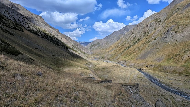
Right near the top the trail basically merged with the creek. In some places the snow was still melting, and over the big boulders there was no other option than to go straight up the middle. I stopped taking off my socks because it would have taken too much time. This was a 4,000-meter pass, and once the sun set, it got very cold. I had to layer up.
At dusk I reached the top and I’d had enough. I was still doing alright, though. For some people that section took two days!
Of course it didn’t end up there. I still needed to get down, and there was no trail. Or I couldn’t see it.
🔦 Which way now?
It was hard to orient in the dark. The route was very similar to the other side. You could probably somehow ride it, but I couldn’t see where, and on top of that there were occasional one-meter drops. The “trail” led me into the bed of a half-dry river with several little streams running through. I didn’t feel like wading anymore. If I had to get to the other side—or at least that’s what I thought—I tried to hop from rock to rock. Sometimes I threw a few stones into the water to make that possible.
In that darkness it felt hopeless. I completely lost motivation when I saw someone had pitched a tent there. I knew it wasn’t a good idea. If it started raining, those streams would swell and quickly turn into a river. I decided to risk it anyway.
I couldn’t get out of the riverbed because there were rock walls on both sides. But I made my bed right at the edge. I prescribed myself a very long sleep—about seven hours—so I could set off after daybreak.
Only after this section did I admit that this would be a very hard race.
Published | #Bikepacking
Silk Road Mountain Race 2025
- We coudn’t care less
- Acclimatization Ride
- Day #1 How I Was Asking For It
- Day #2 How I Caught the Snail
- Day #3 When It Rained Rocks
- Day #4 How I Crossed the Pamir Highway
- Day #5 How I Walked
- Day #6 How I became a sailboat
- Day #7 How I ate a meatless pizza with salami
- Day #8 How I almost froze
- Day #9 How I ate the fateful borscht
- Day #10 How I Was Surprised by Snow
- Day #11 How I Almost Swam
- Day #12 How Soldiers Stopped Me
💬 No comments yet
What are your thoughts? 🤔 Feel free to ask any questions 📫
